
By Anand Parthasarathy
June 7, 2023: The successful May 29 launch of NVS-01, the first of India’s second-generation navigation satellites of the NavIC or Navigation with Indian Constellation class is a significant milestone for multiple reasons.
July 1 this year, marks a decade after India ventured into Space to, create her own indigenous satellite-based positioning system -- Indian Regional Navigation Satellite System – with the launch of the first IRNSS satellite, followed by eight more operational satellites, all in geosynchronous orbit
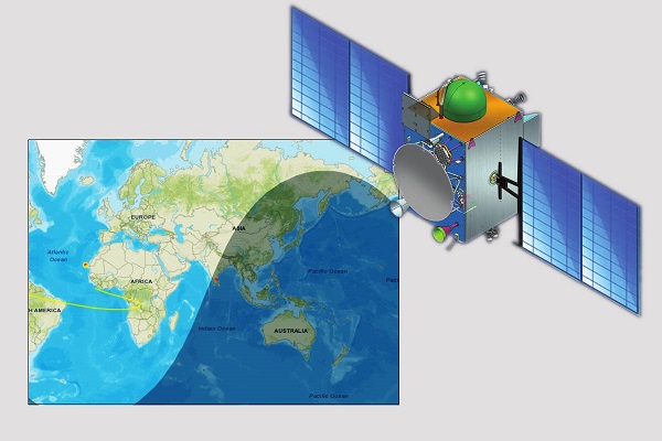
That means the satellites synchronize their revolution with the earth’s rotation which occurs once every 23 hours, 56 minutes and 4.09 seconds. Positioned 35,786 kms above the earth and viewed from earth, they “appear” to be in a fixed position. (You can track NVS-01 live here in this service from n2yo.com)
It takes seven of these satellites to cover the Indian subcontinent and 1500 kms beyond India’s shores and indeed, the ‘R’ in IRNSS spelt out the nation’s mission to create a Regional positioning system over which it would have full operational control in times of peace or conflict.
But times – and geopolitical priorities – have changed since 2013, when IRNSS was initiated and since 2018, when the last of seven satellites required to complete the coverage, was in position. In the five years since, India has subtly repositioned itself on the global political map. It has absorbed the old adage (attributed to the late Robert Kennedy, younger brother of the US President, John Kennedy) that there are no permanent friends or enemies, only permanent interests.
The Internet -- which in concept, belonged to no one person or nation and was therefore beyond political control -- has been controlled at times by many governments, including India.
Could the same thing happen to a global positioning system like GPS, on which much of the world’s navigation, civil and military, depends? In point of fact, GPS is effectively in American control.
Consider a dystopian vision: India is in a state of conflict with another nation and at a critical juncture finds its military navigation systems are effectively ‘switched off’. Current cordiality is no guarantor of future relations, keeping in mind Bobby Kennedy’s cynical mantra.
So, other nations or national groups, coming to this same realization, built their own global positioning systems. Beside the US-controlled GPS, three are up and running: GLONASS (Russian Federation), Beidou (China) and Galileo (European Union).
Two regional satellite-based navigation systems are currently functional: Japan’s Quasi-Zenith Satellite System (QZSS), which in the strict sense is an augmentation of GPS -- and the Indian IRNSS, now renamed NavIC.
From regional to global system
Though not explicitly stated, there are strong pointers that NavIC too will be expanded into a global positioning system. This will require that the present 7-satellite regional system be strengthened with another 24 NavIC satellites to make its coverage global. Is this where India is headed? Absolutely.
Last week’s launch of the first second-generation NavIC, NVS-01, signals this global vision. Consider:
After a decade-long, determined push, India has been allocated spectrum by the International Telecommunication Union (ITU), in the civilian frequency band, L1, most widely used for GPS applications. The mere fact that India lobbied hard for this frequency indicates that her long term vision aims at a global navigation system: it will ensure interoperability with the other four Global Navigation Satellite Systems ( GNSS), now in operation. In all likelihood India will then offer a global NavIC free-for-use, as GPS is today.
There is another reason why the latest NavIC satellite can be said to be the end of the beginning, as well as the beginning of the end of India’s global navigation ambitions:
Made-in-India Rubidium atomic clock
NVs-01 is the first satellite in the NavIC series to incorporate a Rubidium Atomic Clock, similar to what fuels the other four GNSS systems, but developed indigenously at the Space Applications Centre, Ahmedabad. Timing is key to positioning and atomic clocks are as accurate as one can get when it comes to time keeping.
ISRO Chairman S. Somanath stated soon after the May 29 launch that four more NavIC satellites – NVS 02 to 05 -- have been lined up for launch in the near future.
According to an ISRO resource, out of seven satellites, three are placed in what is called geostationary orbit, while the other four are placed in an inclined geosynchronous orbit. Presumably at some early date, a regional coverage with superior accuracy assured by the atomic clock will have been achieved, leaving ISRO to pursue the larger vision of a global footprint.
And in line with the Space department thrust of opening up for private enterprise (reported by Swarajya),it is very likely that once the government puts the funding in place, the path from regional to global navigation will be significantly shortened by entrusting future NavIC production to public-private partnerships.
The first steps have already been taken: the Bengaluru-based Elena Geo Systems recently unveiled a microchip which could perform navigation, positioning and timing functions for systems using NavIC. The Armed Forces are reportedly the first customers – a pointer that NavIC may be a key building block for mission-critical military communication systems in the near future.
Phones with NavIC on board
But for any navigation system with global ambitions, wide civilian usage is important – and in this regard, Indian mobile phone makers have shown themselves to be more responsive to national priorities than some global brands who find their biggest markets here. Admittedly this requires that the primary phone chip is NavIC-ready – and the leading phone processor maker, Qualcomm has already released Snapdragon 460, 662 and 720G chips with onboard NavIC support. Some international brands like Poco, Xiaomi, OnePlus, Asus, Vivo, Realme, Redmi, Iqoo have announced models that include NavIC among positioning systems supported.
It is not as if phone makers have been caught unawares. Even in its first draft issued mid 2021, the Indian Satellite Navigation Policy (SATNAV) stated unambiguously that NavIC functionality was a national objective. Yet the premier phone brands like Samsung and Apple have expressed difficulty in early incorporation of NavIC compatibility in their handsets.
A Reuters news report ( quoted in Business Standard) in September 2022 said: “In private meetings in August and September, representatives of Apple Inc, Xiaomi Corp, Samsung Electronics Co Ltd and others pushed back, citing worries that making phones NavIC-compliant would mean higher research and production costs.”
These players had no difficulty incorporating compatibility with GLONASS, Beidou and Galileo in addition to the default GPS to ensure sales in Europe, China and Russia. In a commercial maidan where handsets are upgraded 2-3 times in a year, these companies have reportedly sought time till 2025 to incorporate NavIC readiness. The enablement of the L1 frequency band in the new generation NavIC satellites will make it a little easier for players like Samsung and Apple to add the compatibility in new handsets.
Beyond civilian phones and the military establishment, the International Maritime Organisation (IMO) has recognized NavIC as a component of worldwide radio navigation for maritime applications which means ships at sea, of all flags, can navigate using NavIC.
With the leading car and transport navigation systems, Mappls from MapMyIndia and Nuvi from Garmin, already NavIC-ready, this may soon be the de facto system for car navigation, fleet management, vehicle tracking and disaster management in India.
For these and many reasons as yet not manifest, the travels of the latest NavIC platform around the earth may constitute one small orbital path for a single satellite, but a giant traverse to the future of self-reliant navigation for a nation.
This article has appeared in Swarajya